by Vaughan Hunt | Mar 2, 2017 | Recreational Ride Routes
| Route Map |
|
Ride description |
 |
|
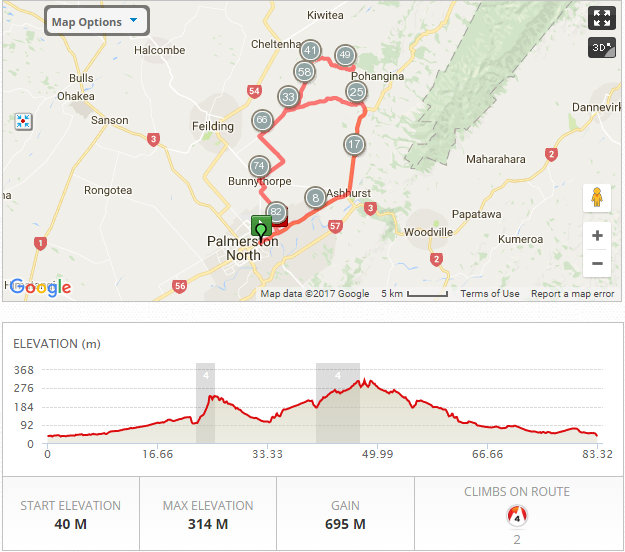
BM06A – Valley Rd, Road to nowhere
Distance: 83km
Description:
Napier Rd, Ashhurst, left at Valley Rd, Right onto Taonui Rd, turn at the end of the seal. Colyton, Reid line E, Dixons Line, Bunnythorpe Tutaki Rd, Home
|
by Vaughan Hunt | Feb 2, 2017 | Recreational Ride Routes
| Route Map |
|
Ride description |
 |
|
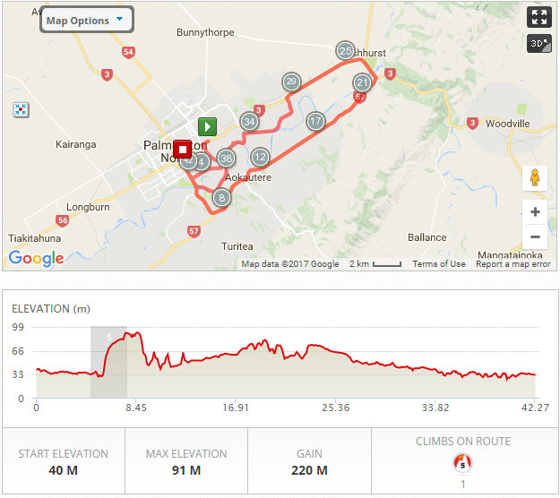
BM22A – Aokautere, Te Matai, Bridle Trail
Distance: 42km
Description:
Ruahine, Te Awe Awe, Summerhill, Aokautere, Ashhurst, Te Matai Rd, optional Bridle Trail & Home
|
by Vaughan Hunt | Feb 2, 2017 | Recreational Ride Routes
| Route Map |
|
Ride description |
 |
|
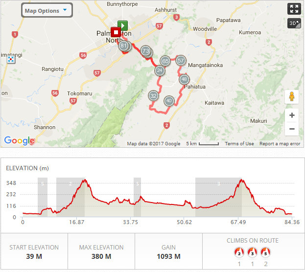
BM22C – Mangamaire
Distance: 85km
Description:
Ruahine, Te Awe Awe, Summerhill, Pahiatua Track, Makomako Rd, Nikau Rd, Tutaekara Rd, Mangamaire, Bridge Rd, Scarborough-Konini Rd, Pahitus Rd, Ballance Rd, Ballance Valley Rd, Pahiatua Track & Home
|
by Vaughan Hunt | Feb 2, 2017 | Recreational Ride Routes
| Route Map |
|
Ride description |
 |
|
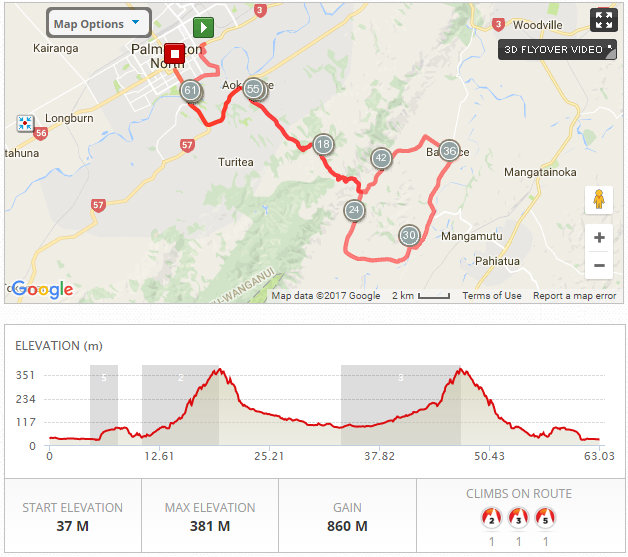
BM22B – Post Office Road
Distance: 63km
Description:
Ruahine, Te Awe Awe, Summerhill, Pahiatua Track, Makomako Rd, Ballance Rd, Ballance Valley Rd, Pahiatua Track & Home
|
by Vaughan Hunt | Feb 10, 2015 | Recreational Ride Routes
| Route Map |
|
Ride description |
 |
|
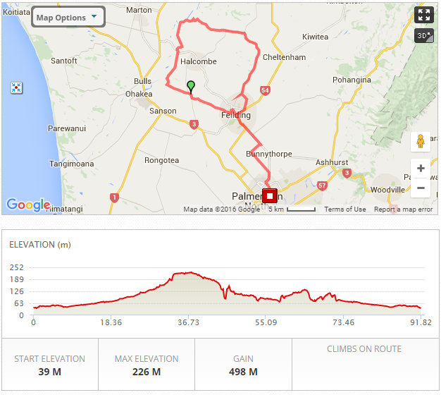
BM33A – Pryces Line, Mt Biggs
Distance: 92km
Description:
Vogel street, Roberts Line , Newbury, Campbells Road, Makino Rd to Pryces line, Mt Stewart Halcombe Rd, Mt Biggs School, Sandon Rd Back though Fielding and return via Roberts line
|
by Vaughan Hunt | Feb 10, 2015 | Recreational Ride Routes
| Route Map |
|
Ride description |
 |
|
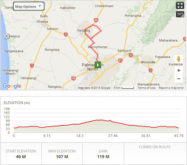
BM33C – Feilding Colyton
Distance: 46km
Description:
Vogel, Railway, Roberts, Newbury, Campbells line, East street, Kimbolton Road Colyton Rd Taonui Road, Campbells line, Roberts Line
|