BikeManawatu Member Profiles
Some of our club members
Member profile – Vaughan Hunt
How long have you been cycling? Since the beginning of 2004 What drew you to the sport? My wife says it is a mid life crisis thing… needing to feel like I can still compete with my peers. Of course I’m sure it was the health benefits and the camaraderie of other...
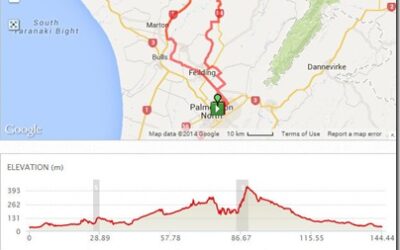
BM31D – Kakariki, Hunterville, Stormy Point
Route Map Ride description BM31D – Kakariki, Hunterville, Stormy Point Distance: 144km Description: Stoney Creek Road, Campbells Road, Feilding, Sandon Road to Mt Biggs, Ngaio Road and Mingaroa Road to Kakariki, SH 1 to Hunterville. From...
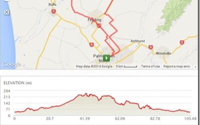
BM31C – Beaconsfield, Stanway, Halcombe, Feilding
Route Map Ride description BM31C – Beaconsfield, Stanway, Halcombe, Feilding Distance: 103km Description: Stoney Creak, Bunnythorpe, Dixons Line, Reid Line East, Colyton, Kimbolton Rd, Cheltenham, Haynes Line, Beaconsfield, McKays Line, Makino Rd,...
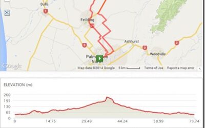
BM31B – Colyton, Cinders Hill, Feilding
Route Map Ride description BM31B – Colyton, Cinders Hill, Feilding Distance: 73km Description: Stoney Creak, Bunnythorpe, Dixons Line, Reid Line East, Colyton, ,Kimbolton Rd, Cinders Hill, McKays Line, Makino Rd, Campbell Road, Ruff Road, KB to Roberts...
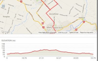
BM31A – Colyton, Feilding
Route Map Ride description BM31A – Colyton, Feilding Distance: 53km Description: Vogel St, Railway Rd, Roberts Line, Nannestads Line , Colyton, Kimbolton , Norfolk Cr , Reid Line Makino Back via Campbells , Ruff Road, KB to Roberts...
BM32C – Feilding, Awahuri
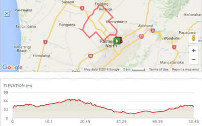
Route Map Ride description BM32C – Feilding, Awahuri Distance: 50km Description: Vogel St, Railway Rd, Roberts Line, Newbury Line , Campbel Rd, Feilding, Awahuri , Green Rd, Rongotea Rd, Aranui, Gillespies Line and Home.
BM32B – Feilding, Mt Stewart, Rongotea
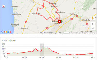
Route Map Ride description BM32B – Feilding, Mt Stewart, Rongotea Distance: 66km Description: Vogel St, Railway Rd, Roberts Line, Newbury Line , Campbel Rd, Feilding, Sandon Rd, Mt Stewart, Penny Rd, Waitohi Rd, Rongotea, Longbern-Rongotea Rd,...
BM32A – Feilding, Ohakea, Rongotea
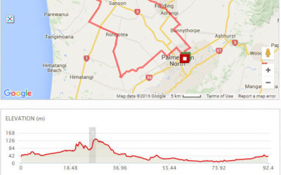
Route Map Ride description BM32A – Feilding, Ohakea, Rongotea Distance: 92km Description: Vogel St, Railway Rd, Roberts Line, Newbury Line , Campbell Rd, Feilding, Sandon Rd, Ngaio Rd, Wilson Rd, Ohakea, Tangimoana Rd, Campion Rd, Rongotea,...
BM29C – Longburn, Main Drain, Mt Biggs, Feilding Watershed
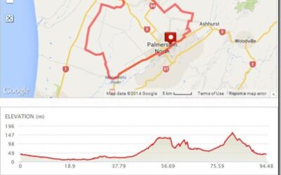
Route Map Ride description BM29C – Longburn, Main Drain, Mt Biggs, Feilding Watershed Distance: 95km Description: College St, Pioneer Hwy, SH56, Longburn, Main Drain, Rongotea, Penny Rd, Sandon Rd, Feilding, Cambell Rd, Nannestede Line, Reid Line East,...
BM29B – Longburn, Main Drain, Mt Biggs, Feilding
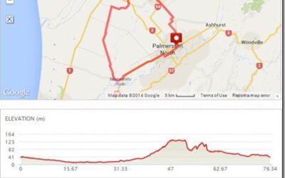
Route Map Ride description BM29B – Longburn, Main Drain, Mt Biggs, Feilding Distance: 78km Description: College St, Pioneer Hwy, SH56, Longburn, Main Drain, Rongotea, Penny Rd, Sandon Rd, Feilding, Cambell Rd, Waughs Rd, KB Line, Roberts Line and...
BM29A – Longburn, Main Drain, Lockwood Rd
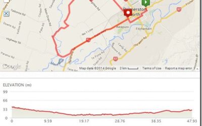
Route Map Ride description BM29A – Longburn, Main Drain, Lockwood Rd Distance: 48km Description: College St, Pioneer Hwy, SH56, Longburn, Main Drain, Hoihere Rd, Lockwood Rd, Aranui Rd, Gillespies Line,...

