BM28a Bunnythorpe, Colyton, Ashhurst
| Route Map | Ride description | |
 |
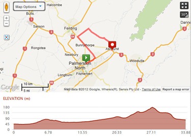
BM28a Bunnythorpe, Colyton, Ashhurst Distance: 47km Description: |

| Route Map | Ride description | |
 |
BM28a Bunnythorpe, Colyton, Ashhurst Distance: 47km Description: |

| Route Map | Ride description | |
 |
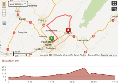
BM28b Bunnythorpe, Valley Rd, Ashhurst Distance: Description: |

| Route Map | Ride description | |
 |
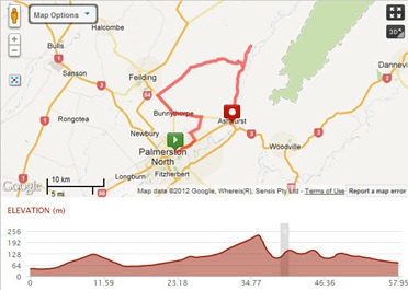
BM28c Colyton-Pohangina-Ashhurst Distance: Description: |
Start from Palm Nth and head out on Napier Rd to Ashhurst, turn left in to Ashhurst and along Cambridge St, turn left on to Oxford St and head out of Ashhurst up the hill and turn left on to Watershed Rd. At Hiwinui turn right on to Reids Line East, then turn left on to Dixons line. At Bunnythorpe turn left and follow the railway lines along and turn right on to Stoney Creek Rd, turn right on to Clevely, left on to Sangsters, left on to Tutaki Rd, turn right on to Kelvin Grove Rd then back in to Palmerston North
Medium Ride BM30b Flat 66k Cafe ride
Napier Road , Left on to Roberts line left on to Kelvin grove Road back around on to Roberts Line, Newbury line ,crossSH3 ,Right on to Rongotea rd, Left on to Lockwood Rd, Right on to Hoihere Rd, Left on to Main Drain ,Left on to SH56, Right on to Alve Rd Right to Opiki , Left on to Tane Rd, Left on to Linton Drain Rd, Left on to SH 57, Carry on through Linton past Massey back to Palmerston North To Esplanade Cafe
You can view and print the map of this route by clicking on the link below.
http://www.mapmyride.com/ride/new-zealand/palmerston-north/384203460903
Long Ride BM30A flat Café 75k
Napier Rd, Left on to Stoney Creek,Through Bunnythorpe on Campbells Line over the Railway line and over the Oroua River to Feilding , Left on South St, Left on to Kawakawa Rd,Left on to Awahuri Rd Left on to SH# then a right on to Green Road, continue to the end and turn left on to Rongotea Rd, turn right on to Lockwood Rd, Right on to Hoihere Rd, Left on to Main Drain ,Left on to SH56, Right on to Alve Rd Right to Opiki , Left on to Tane Rd, Left on to Linton Drain Rd, Left on to SH 57, Carry on through Linton past Massey back to Palmerston North To Esplanade Cafe
You can view and print the map of this route by clicking on the link below
http://www.mapmyride.com/ride/new-zealand/palmerston-north/799827957862
This is a short flat ride that heads out of Palmerston North on Main St turns left on to Vogel St, Left on to Tremaine Ave and continues right along till it becomes No1 Line, then when you are at the end it turns left – when you reach SH56 turn right and go to Opiki, left on to Tane Road, Left on to Linton Drain Rd, Left on to SH57 back to Palmerston North past Massey over the bridge to Esplanade Cafe
You can view the map by clicking on the following link.
http://www.mapmyride.com/ride/new-zealand/palmerston-north/448134153098